What can MapMate do..
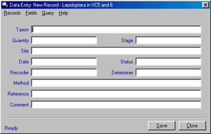
| Quick and simple data entry: |
-
Data Entry features a simplified version of the National Biodiversity Network (NBN) data model - recording just those items you need to keep. Including: site/location, species, quantity, sex, stage, status, date, recorder, determiner, method and a reference - plus a free comment field for additional details.
-
Enter species names whichever way you wish - by scientific or common name - or by standard coding and numbering systems. The program will try to match your entry from minimal and even misspelled typing.
-
A host of features are built-in to help with your data entry - all identified by recorders and enthusiasts. As you enter data, you can instantly check for: recent records, early and late dates, flight periods, other recorders, other recorded sites and much more!
-
Powerful Query functions are available from the data entry screen allowing you to find records, sites or recorders that match any criteria you enter.
-
Create listings and text export files for any criteria for import into other applications.
-
F1 context sensitive help is always available to give you advice on any aspect of your recording.
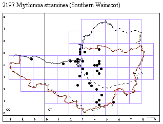
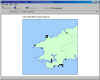
| Produce instant distribution maps: |
.
-
Distribution maps automatically update as you enter data and as you receive records via email from other users in your area - giving you the very latest picture.
-
Another unique MapMate feature is the ability to click on screen and trace back from 'dots' to the original records - giving full data on recorders, dates, localities and other original information!
-
You can copy maps into most word processor or other applications to create your own publications, atlases and newsletters.
-
Print your maps in 'one to a page' or in entire atlases of thumbnails! Save as EPS files for Mac or professional publication.
-
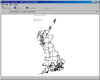
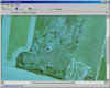
MapMate 2 also supports 'raster' or picture maps as backgrounds and has built in calibration for accurate co-ordinate location - plus the latest (2002) hi resolution GB Admin Area boundaries including Unitary Areas and County Districts. You can mix raster and vector data to combine say aerial photography with vector compartment outlines for the ultimate in reserve recording!
 Click here for more on mapping
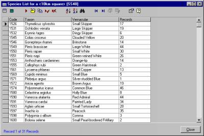
| Analyse your data: |
..
-
Pre designed queries range from a simple 'species list for a 10km square' to complex species richness analysis. Queries have been designed by users and represent all popular data requests!
-
View your records by species by year, by grid-squares, by recording method, by recorders, search for duplication, show flight times, new records this year, relative abundance... or just browse through your data...
-
Copy and paste results into word processors or spreadsheets for further processing or presentation.
-
Advanced users can write their own queries in SQL - or query the database directly from applications like Access.
| Share your data with other users: |
Replication allows any user to exchange records with any other user having similar species and geographic area interests. Replication creates a network of recorders in local or national groups.
 No
other recording program gives you this technology!
No
other recording program gives you this technology!-
Send and receive data via email or directly via the web - data files are created automatically for any other user - MapMate knows exactly what to transfer - you just click the go button.
-
Data is created in a special compact format to reduce internet transfer time.
-
Replication is ideal for special interest groups where many users can contribute to a shared resource.
All this for just £36 - Click HERE for order information
Copyright MapMate Ltd. 2020. All Rights Reserved.